What Makes Ratnapura Hotter? A Closer Look.
In recent days, an analysis of maximum temperature variations across the island reveals that the data recorded at the Ratnapura Meteorological Station is notably higher compared to other stations. This article investigates the distinct factors contributing to these elevated temperatures in the Ratnapura region.
What Makes Ratnapura Unique?
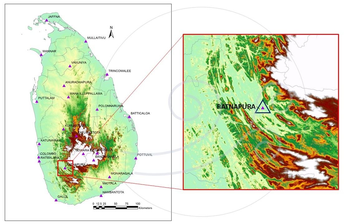
The Ratnapura region is characterized by distinct geographical and climatic features. Located on the western slopes of Sri Lanka’s central highlands, it experiences significant rainfall throughout the year, particularly during the southwest monsoon season. Climatic records indicate that January and February are the driest months, while the remaining months having higher rainfall totals and more frequent rainy days. This article is based on data collected from the Ratnapura Regional Meteorological Observatory, operated by the Department of Meteorology. As illustrated in Figure 01, the observatory is situated in a valley at coordinates 6.68°N latitude, 80.4°E longitude, and an elevation of 86 meters above sea level.
Understanding Maximum and Minimum Temperatures:
The Department of Meteorology, along with national meteorological services worldwide, records two key daily observational parameters: maximum and minimum temperatures. These measurements are taken using specialized thermometers—a mercury thermometer for maximum temperatures and an alcohol thermometer for minimum temperatures. Each parameter is recorded once per day, with maximum temperatures typically observed during the daytime and minimum temperatures during the early morning.
The daily maximum and minimum temperature values recorded across Sri Lanka are available on the Department of Meteorology’s Facebook page. Figure 02 illustrates the variations in maximum temperatures from February 1 to 15, 2025. A key observation is that the highest maximum temperatures on the island are consistently recorded at the Ratnapura observatory during this period.

Why Does This Happen?
The climate of any region is influenced by its geographical location and unique physical features. In Sri Lanka, the behavior of key climatic parameters—such as rainfall, temperature, and wind patterns—is shaped by these distinctive characteristics.
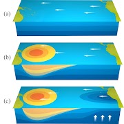
Southwest Monsoon:Period: May to SeptemberRainfall and Wind: Moisture-rich winds from the southwest ascend the central highlands, leading to orographic lifting and cloud formation, which result in rainfall in the southwestern regions.Temperature: Temperatures decrease in the southwestern regions due to rainy weather, while other areas, particularly Eastern and Northeastern parts, experience a rise in temperature.Northeast Monsoon:Period: December to FebruaryRainfall and Wind: Moisture-rich winds from the northeast ascend the central highlands, causing orographic lifting and cloud formation, which bring rainfall to the northeastern regions.Temperature: Temperatures decrease in the eastern and northeastern regions due to rainy weather, while other areas having a slight increase in temperature.Inter-Monsoon Periods:Period: March to April and October to NovemberRainfall and Wind: Convection-driven clouds lead to scattered or isolated rain or thunderstorms across the island.Temperature: Temperature variations continue to depend on altitude.
According to Figure 04, the highest maximum temperatures in Ratnapura are recorded during February, March, and April. While March and April are generally warmer across the entire island, Ratnapura’s temperatures are notably higher due to specific factors. These include solar radiation, geographical features, rainfall patterns, and wind dynamics.
Following are three primary reasons explain Ratnapura’s elevated temperatures:
1. Heat Trapping in a Valley:
Ratnapura is situated in a valley surrounded by mountains. During the day, solar heating warms the ground and air, which then becomes trapped within the valley due to the surrounding topography. This phenomenon, illustrated in Figures 03 and 01, results in persistently higher temperatures in the lower atmosphere near the ground.
2. Temperature Increase in the Southwestern region Due to Northeast Monsoon Winds:
During the northeast monsoon, winds ascend the central highlands and descend along the western slopes, creating localized, relatively high-pressure zones through adiabatic compression. This process warms the western slopes (see: Dry Adiabatic Lapse Rate). Additionally, when these moisture-laden winds cause rainfall in the eastern and northeastern regions, the associated energy exchange generates dry winds that move toward the western slopes. As a result, the southwestern regions, including Ratnapura, experience higher-than-usual temperatures (see: Dry and Wet Adiabatic Lapse Rates).

3. Limited Air Circulation:
When solar radiation heats the land, the warm air remains trapped if there is no mechanism to dissipate the heat. Ratnapura, located about 50 kilometers east of the western sea, is shielded by surrounding mountains that restrict the flow of sea breezes or land breezes. Furthermore, its relatively low elevation compared to the surrounding terrain, minimizes the influence of monsoon winds and other weather systems, further reducing air circulation and contributing to heat accumulation.

So, Doesn’t Ratnapura’s Daytime Temperature Decrease?
Rainfall is a key factor in reducing heat in Ratnapura. As shown in Figure 04, daytime temperatures in Ratnapura decrease during the southwest monsoon season, likely due to the increased frequency of rainy days during this period.
In addition to rainfall, vegetation also plays a significant role in regulating temperatures. However, this article does not quantitatively analyze its impact.
An Additional Note!
Recently, there has been growing concern about rising air pollution levels across the island. This increase is primarily driven by locally generated pollutants from industrialization and fossil fuel use, as well as transboundary pollutants from other countries.
Considering Ratnapura’s unique climatic and geographical context, any increase in air pollution could be exacerbated by the region’s limited airflow due to its topography. This would hinder the dispersal of pollutants, making rainfall the primary mechanism for air purification. Therefore, it is crucial to minimize air pollution levels in Ratnapura to safeguard the health of its residents.
While I am not an expert on this topic, I believe it warrants further research. Such studies could help identify Ratnapura’s environmental vulnerabilities and guide the development of effective strategies for the future.
_______________
I would like to extend my gratitude to:
Retired Director General of Meteorology, Mr. Sarath Premalal, and Dr. Shiromani Jayawardena for their expert insights during the preparation of this article.
The Department of Meteorology for providing climate and temperature data.
Readers of my blog and Facebook page, for inquiring this issue.
Meteorologist
National Meteorological Centre
Plotting Tools: MS Excel, Python, ArcGIS


0 Comments